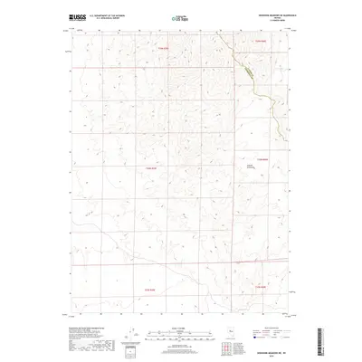
2018 Map of Shoshone Meadows NE
USGS Topo · Published 2018About this map
The Augusta Mountains dominate the eastern landscape of this high-desert region on the border of Churchill and Lander counties. This 2018 survey captures a terrain defined by significant elevation changes and deep drainage patterns, characteristic of the Great Basin's rugged topography. Evidence of life in this arid environment is centered on isolated water sources like Cain Spring, located in the northeastern corner of the map. The map provides a precise layout of the Public Land Survey System, illustrating the grid of townships and ranges such as t24n r39e and t25n r40e that divide this remote interior. The sparse network of secondary roads and 4WD tracks reflects the area's isolation and its primary use for ranching or resource management within the high Nevada desert.
Find a feature on this map
9 named features on this map. Tap any name to fly to it.
Don’t see what you’re looking for? This feature index may not catch every label — zoom into the map to look around manually.
Map Details
Editions of this 2018 Shoshone Meadows NE Map
This is the sole edition of this map. No revisions or reprints were ever made.
Other maps of this area

1932 · Sonoma Range
USGS Topo · 1:250,000

1939 · Sonoma Range
USGS Topo · 1:250,000

1955 · Millett
USGS Topo · 1:250,000

1955 · Winnemucca
USGS Topo · 1:250,000

1958 · Winnemucca
USGS Topo · 1:250,000

1959 · Millett
USGS Topo · 1:250,000

1961 · Cain Mountain
USGS Topo · 1:62,500

1961 · Mt. Moses
USGS Topo · 1:62,500

1962 · Winnemucca
USGS Topo · 1:250,000

1966 · Shoshone Meadows
USGS Topo · 1:62,500