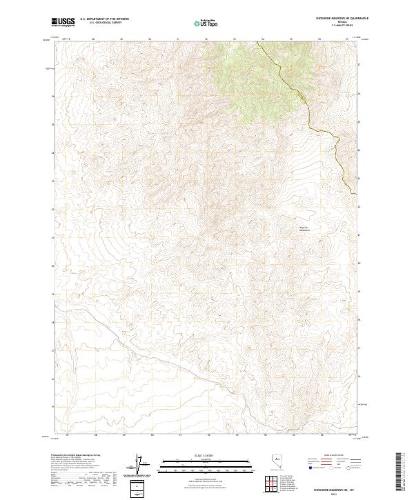
2021 Map of Shoshone Meadows NE
USGS Topo · Published 2021About this map
The Augusta Mountains dominate this high-desert landscape along the border of Lander and Churchill Counties. This 2021 topographic survey reveals a rugged, sparsely populated region defined by dramatic elevation changes and essential water sources like Cain Spring. The map provides an intricate look at the public land survey system divisions across Townships 23, 24, and 25 North, illustrating how legal boundaries bisect the terrain. Sparse human intervention is evident, with only a few unimproved roads or trails traversing the eastern slopes, emphasizing the isolated character of this Great Basin environment.
Find a feature on this map
3 named features on this map. Tap any name to fly to it.
Don’t see what you’re looking for? This feature index may not catch every label — zoom into the map to look around manually.
Map Details
Editions of this 2021 Shoshone Meadows NE Map
This is the sole edition of this map. No revisions or reprints were ever made.
Other maps of this area

1932 · Sonoma Range
USGS Topo · 1:250,000

1939 · Sonoma Range
USGS Topo · 1:250,000

1955 · Millett
USGS Topo · 1:250,000

1955 · Winnemucca
USGS Topo · 1:250,000

1958 · Winnemucca
USGS Topo · 1:250,000

1959 · Millett
USGS Topo · 1:250,000

1961 · Cain Mountain
USGS Topo · 1:62,500

1961 · Mt. Moses
USGS Topo · 1:62,500

1962 · Winnemucca
USGS Topo · 1:250,000

1966 · Shoshone Meadows
USGS Topo · 1:62,500