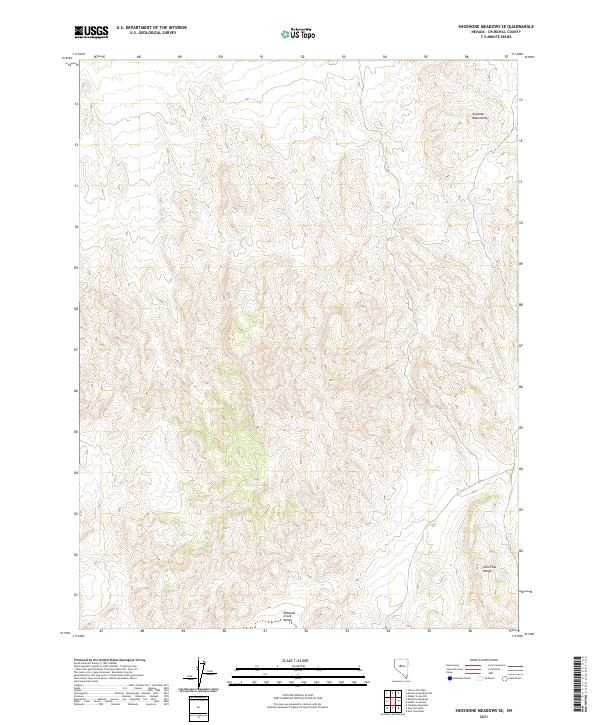
2021 Map of Shoshone Meadows SE
USGS Topo · Published 2021About this map
Edwards Creek Valley occupies the southern reaches of this high-desert landscape in Churchill County. This topographical study focuses on the dramatic elevation changes between the Augusta Mountains to the north and the New Pass Range in the southeast. While devoid of named settlements or major infrastructure, the map reveals the complex drainage patterns and ridgelines of the Great Basin, punctuated by high peaks reaching over 6,800 feet. The region is defined by the Public Land Survey System grid, specifically within townships t23n r39e and t23n r40e, illustrating the vast, unpopulated character of Nevada’s interior mountains in the early twenty-first century.
Find a feature on this map
7 named features on this map. Tap any name to fly to it.
Don’t see what you’re looking for? This feature index may not catch every label — zoom into the map to look around manually.
Map Details
Editions of this 2021 Shoshone Meadows SE Map
This is the sole edition of this map. No revisions or reprints were ever made.
Other maps of this area

1955 · Millett
USGS Topo · 1:250,000

1959 · Millett
USGS Topo · 1:250,000

1966 · Shoshone Meadows
USGS Topo · 1:62,500

1966 · Edwards Creek Valley
USGS Topo · 1:62,500

1969 · Gilbert Creek SW
USGS Topo · 1:24,000
1969 · Gilbert Creek NW
USGS Topo · 1:24,000

1969 · Mount Airy NW
USGS Topo · 1:24,000

1983 · Edwards Creek Valley
USGS Topo · 1:100,000
1990 · Hole In The Wall
USGS Topo · 1:24,000
1990 · Shoshone Meadows
USGS Topo · 1:24,000