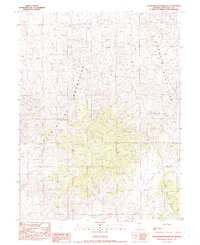
1990 Map of Shoshone Meadows SE
USGS Topo · Published 1990About this map
Edwards Creek Valley sits at the heart of this high-desert landscape, flanked by the dramatic peaks of the Clan Alpine Mountains and the Augusta Mountains. Surveyed for this provisional map at the end of the 1980s, the terrain reveals the essential water sources required for life in this arid region of Churchill County. Significant landmarks such as Hole in the Wall Well and New Pass Well indicate the strategic locations of water infrastructure used by ranchers and travelers moving between the ranges. To the southeast, the New Pass Range adds further complexity to the land, which shows a classic Basin and Range topography where wide valleys are sharply defined by isolated mountain chains.
Find a feature on this map
6 named features on this map. Tap any name to fly to it.
Don’t see what you’re looking for? This feature index may not catch every label — zoom into the map to look around manually.
Map Details
Editions of this 1990 Shoshone Meadows SE Map
This is the sole edition of this map. No revisions or reprints were ever made.
Other maps of this area

1955 · Millett
USGS Topo · 1:250,000

1959 · Millett
USGS Topo · 1:250,000

1966 · Shoshone Meadows
USGS Topo · 1:62,500

1966 · Edwards Creek Valley
USGS Topo · 1:62,500

1969 · Gilbert Creek SW
USGS Topo · 1:24,000
1969 · Gilbert Creek NW
USGS Topo · 1:24,000

1969 · Mount Airy NW
USGS Topo · 1:24,000

1983 · Edwards Creek Valley
USGS Topo · 1:100,000
1990 · Hole In The Wall
USGS Topo · 1:24,000
1990 · Shoshone Meadows
USGS Topo · 1:24,000