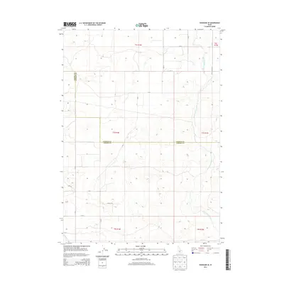
2013 Map of Shoshone SE
USGS Topo · Published 2013About this map
Milner Gooding Canal arcs through this high desert terrain, illustrating the critical role of 20th-century irrigation in shaping the landscape of Southern Idaho. The sheet covers the transition between Jerome and Lincoln Counties, where the geometric grid of the Public Land Survey System meets the sinuous path of large-scale water projects. The presence of the N Side Main Canal in the southwestern corner further emphasizes the region's reliance on managed water for agriculture and settlement. Local transit is defined by a strictly aligned road network, including arterial routes like Dietrich Butte Rd and numbered county lines such as E 400 N and E 300 N. This 2013 survey provides a clear view of the engineering required to sustain this arid region, showing the relationship between county boundaries and the life-giving canal systems.
Find a feature on this map
12 named features on this map. Tap any name to fly to it.
Don’t see what you’re looking for? This feature index may not catch every label — zoom into the map to look around manually.
Map Details
Editions of this 2013 Shoshone SE Map
This is the sole edition of this map. No revisions or reprints were ever made.
Other maps of this area

1955 · Twin Falls
USGS Topo · 1:250,000

1958 · Twin Falls
USGS Topo · 1:250,000

1964 · Falls City
USGS Topo · 1:24,000

1964 · Perrine
USGS Topo · 1:24,000

1964 · Hunt
USGS Topo · 1:24,000

1971 · Shoshone SE
USGS Topo · 1:24,000

1971 · Star Lake
USGS Topo · 1:24,000

1971 · Dietrich
USGS Topo · 1:24,000
1971 · Shoshone SW
USGS Topo · 1:24,000

1971 · Dietrich Butte
USGS Topo · 1:24,000