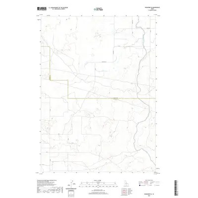
2020 Map of Shoshone SE
USGS Topo · Published 2020About this map
The Milner Gooding Canal snakes across this agricultural landscape, defining the water management patterns of southern Idaho. Serving both Jerome Co and Lincoln Co, the canal system and its various offshoots like Lateral 702A3 provide the essential infrastructure for local farming. The map reveals a strictly regulated grid of section lines and rural thoroughfares, including Red Bridge Rd, Messervy Rd, and Seiffer Rd, which partition the high desert terrain into productive tracts. This 2020 survey illustrates the continued importance of the Public Land Survey System, showing the township and range boundaries such as t7s r19e that have dictated land ownership and development in the region for over a century.
Find a feature on this map
24 named features on this map. Tap any name to fly to it.
Don’t see what you’re looking for? This feature index may not catch every label — zoom into the map to look around manually.
Map Details
Editions of this 2020 Shoshone SE Map
This is the sole edition of this map. No revisions or reprints were ever made.
Other maps of this area

1955 · Twin Falls
USGS Topo · 1:250,000

1958 · Twin Falls
USGS Topo · 1:250,000

1964 · Falls City
USGS Topo · 1:24,000

1964 · Perrine
USGS Topo · 1:24,000

1964 · Hunt
USGS Topo · 1:24,000

1971 · Shoshone SE
USGS Topo · 1:24,000

1971 · Star Lake
USGS Topo · 1:24,000

1971 · Dietrich
USGS Topo · 1:24,000
1971 · Shoshone SW
USGS Topo · 1:24,000

1971 · Dietrich Butte
USGS Topo · 1:24,000