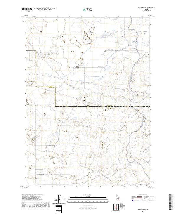
2023 Map of Shoshone SE
USGS Topo · Published 2023About this map
The Milner Gooding Canal snakes through this high desert agricultural landscape along the border of Lincoln and Jerome Counties. This map documents a modern irrigation network that is vital to the region's agricultural economy, showing the complex system of secondary channels like Lateral 702A3. The terrain is defined by the rigid grid of the Public Land Survey System, with roads like Messervy Rd and Martin Rd following section lines across the basalt-strewn plains. The presence of Red Bridge Rd suggests localized infrastructure tailored to the undulating topography of the Snake River Plain. For researchers, the map provides a contemporary view of land use and water management in a part of Idaho where the desert has been methodically transformed into productive acreage through engineered waterways.
Find a feature on this map
22 named features on this map. Tap any name to fly to it.
Don’t see what you’re looking for? This feature index may not catch every label — zoom into the map to look around manually.
Map Details
Editions of this 2023 Shoshone SE Map
This is the sole edition of this map. No revisions or reprints were ever made.
Other maps of this area

1955 · Twin Falls
USGS Topo · 1:250,000

1958 · Twin Falls
USGS Topo · 1:250,000

1964 · Falls City
USGS Topo · 1:24,000

1964 · Perrine
USGS Topo · 1:24,000

1964 · Hunt
USGS Topo · 1:24,000

1971 · Shoshone SE
USGS Topo · 1:24,000

1971 · Star Lake
USGS Topo · 1:24,000

1971 · Dietrich
USGS Topo · 1:24,000
1971 · Shoshone SW
USGS Topo · 1:24,000

1971 · Dietrich Butte
USGS Topo · 1:24,000