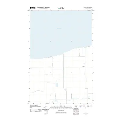
2010 Map of Shotley
USGS Topo · Published 2010About this map
Upper Red Lake defines the northern reaches of this Beltrami County landscape, where the shoreline meets a grid of rural roads and timbered tracts. The settlement of Shotley serves as the local anchor, situated south of the lake and north of the winding North Branch Battle River. This 2010 survey reflects a region defined by its proximity to the water and the Red Lake State Frst, with land use patterns established by forestry and early 20th-century homesteading. For those researching local lineages, the Foy Cemetery stands at the southeastern corner of the map near Trails End Rd Ne. The road network, including family-named routes like Sandberg Rd Nc and Sunflower Rd Ne, illustrates the sparse but persistent habitations of the Minnesota northwoods.
Find a feature on this map
16 named features on this map. Tap any name to fly to it.
Don’t see what you’re looking for? This feature index may not catch every label — zoom into the map to look around manually.
Map Details
Editions of this 2010 Shotley Map
This is the sole edition of this map. No revisions or reprints were ever made.
Other maps of this area

1919 · Fox
USGS Topo · 1:62,500

1919 · Quiring
USGS Topo · 1:62,500

1919 · Ponemah
USGS Topo · 1:62,500

1943 · Ponemah
USGS Topo · 1:62,500

1954 · Bemidji
USGS Topo · 1:250,000

1954 · Roseau
USGS Topo · 1:250,000

1957 · Roseau
USGS Topo · 1:250,000

1957 · Bemidji
USGS Topo · 1:250,000

1958 · Bemidji
USGS Topo · 1:250,000

1958 · Roseau
USGS Topo · 1:250,000