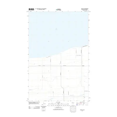
2013 Map of Shotley
USGS Topo · Published 2013About this map
Upper Red Lake dominates the northern horizon of this landscape, its shoreline meeting the edge of the Red Lake State Frst just north of the small settlement at Shotley. The area is characterized by a grid of rural roads and forestry tracks, such as Pioneer Rd Ne and Shotley Rd Ne, which navigate the low-lying terrain near the N Br Battle River. This southern watercourse meanders through the township, providing drainage for the surrounding woodlands and wetlands. Genealogists and local historians will find the Foy Cem located in the southeastern quadrant, a solitary landmark in an area otherwise defined by timber management and sparse habitation. The transition from the lake shore to the interior forest is marked by a series of north-south routes like Pit Rd Ne and Artesian Spring Rd Ne, reflecting the region's reliance on secondary road networks for both residential access and state forest utility.
Find a feature on this map
15 named features on this map. Tap any name to fly to it.
Don’t see what you’re looking for? This feature index may not catch every label — zoom into the map to look around manually.
Map Details
Editions of this 2013 Shotley Map
This is the sole edition of this map. No revisions or reprints were ever made.
Other maps of this area

1919 · Fox
USGS Topo · 1:62,500

1919 · Quiring
USGS Topo · 1:62,500

1919 · Ponemah
USGS Topo · 1:62,500

1943 · Ponemah
USGS Topo · 1:62,500

1954 · Bemidji
USGS Topo · 1:250,000

1954 · Roseau
USGS Topo · 1:250,000

1957 · Roseau
USGS Topo · 1:250,000

1957 · Bemidji
USGS Topo · 1:250,000

1958 · Bemidji
USGS Topo · 1:250,000

1958 · Roseau
USGS Topo · 1:250,000