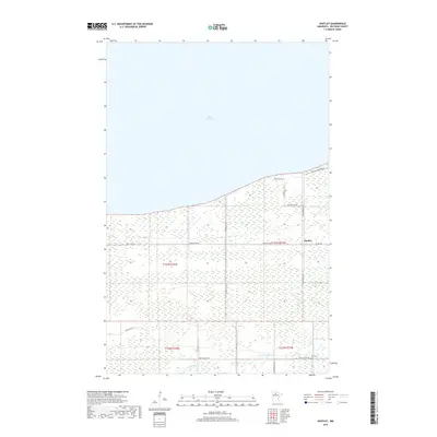
2019 Map of Shotley
USGS Topo · Published 2019About this map
Upper Red Lake dominates the northern horizon of this landscape in Beltrami County, where the shoreline meets a complex network of wetlands and rural tracts. The small settlement of Shotley sits near the intersection of Sunflower Rd Ne and Co Rd 108, serving as a local anchor in an area defined by its proximity to the water. To the south, the N Br Battle River meanders through the terrain, flanked by remote routes like Trails End Rd Ne. Local history is preserved at the Fox Cem near the river's path, while the grid of the Public Land Survey System—including t153n r31w and t152n r31w—structures the landscape of woods and marshes. Notable local names are preserved in the road network, including Whipple Ln Ne and Artesian Spring Rd Ne, marking family landholdings and natural features near the lake's edge.
Find a feature on this map
22 named features on this map. Tap any name to fly to it.
Don’t see what you’re looking for? This feature index may not catch every label — zoom into the map to look around manually.
Map Details
Editions of this 2019 Shotley Map
This is the sole edition of this map. No revisions or reprints were ever made.
Other maps of this area

1919 · Fox
USGS Topo · 1:62,500

1919 · Quiring
USGS Topo · 1:62,500

1919 · Ponemah
USGS Topo · 1:62,500

1943 · Ponemah
USGS Topo · 1:62,500

1954 · Bemidji
USGS Topo · 1:250,000

1954 · Roseau
USGS Topo · 1:250,000

1957 · Roseau
USGS Topo · 1:250,000

1957 · Bemidji
USGS Topo · 1:250,000

1958 · Bemidji
USGS Topo · 1:250,000

1958 · Roseau
USGS Topo · 1:250,000