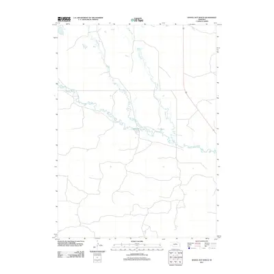
2011 Map of Shovel Dot Ranch
USGS Topo · Published 2011About this map
The Calamus River meanders across this northern Nebraska landscape, defining the central geography of the quadrangle. This area of Loup County remains dominated by ranchland and river systems, where the braided path of the river is joined by smaller tributaries and seasonal watercourses. Notable among these are Skull Creek and Bloody Creek, which drain the northern terrain toward the main river valley. Along the banks, the Fox Bayou represents a distinct hydrological feature typical of the region's river morphology. Settlement is sparse, with the primary transportation corridor provided by Highway 183, which cuts a straight line through the grassy plains to the east, connecting these remote ranching lands to the wider county network.
Find a feature on this map
5 named features on this map. Tap any name to fly to it.
Don’t see what you’re looking for? This feature index may not catch every label — zoom into the map to look around manually.
Map Details
Editions of this 2011 Shovel Dot Ranch Map
This is the sole edition of this map. No revisions or reprints were ever made.
Other maps of this area

1952 · Taylor NW
USGS Topo · 1:24,000

1952 · Almeria NE
USGS Topo · 1:24,000

1952 · Almeria NW
USGS Topo · 1:24,000

1955 · Broken Bow
USGS Topo · 1:250,000

1955 · O'Neill
USGS Topo · 1:250,000

1956 · Broken Bow
USGS Topo · 1:250,000

1959 · O'Neill
USGS Topo · 1:250,000

1969 · O'Neill
USGS Topo · 1:250,000

1981 · Boiling Spring
USGS Topo · 1:24,000

1981 · Stonehouse Ranch NW
USGS Topo · 1:24,000