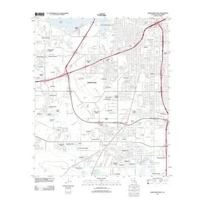
2012 Map of Shreveport West
USGS Topo · Published 2012About this map
Cross Lake and its intricate coves like Gar Pocket and Cottons Pocket anchor the northern boundary of this detailed Caddo Parish survey. The landscape reflects a mid-century expansion of residential developments, showing a dense network of neighborhoods including Western Hills Village, Willow Ridge, and Summer Grove. These subdivisions are woven between the major transportation arteries of Interstate 20 and Interstate 49, which intersect near the heart of the city.
Find a feature on this map
77 named features on this map. Tap any name to fly to it.
Don’t see what you’re looking for? This feature index may not catch every label — zoom into the map to look around manually.
Map Details
Editions of this 2012 Shreveport West Map
This is the sole edition of this map. No revisions or reprints were ever made.
Other maps of this area

1932 · Bossier SW
USGS Topo · 1:31,680

1932 · Shreveport SE
USGS Topo · 1:31,680

1941 · Forbing
USGS Topo · 1:31,680

1945 · Greenwood
USGS Topo · 1:62,500

1948 · Mooringsport
USGS Topo · 1:62,500

1948 · Bossier City
USGS Topo · 1:62,500

1948 · Caspiana
USGS Topo · 1:62,500

1955 · Shreveport
USGS Topo · 1:250,000
1955 · Bossier City
USGS Topo · 1:24,000

1955 · Shreveport East
USGS Topo · 1:24,000