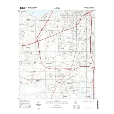
2015 Map of Shreveport West
USGS Topo · Published 2015About this map
Shreveport expands westward toward the shores of Cross Lake in this 2015 study, revealing a landscape defined by densely platted residential additions and a significant concentration of historical burial grounds. The northeastern corner is particularly rich in genealogy potential, containing the Hebrew Rest Cem, Saint Joseph Cem, and Star Cem. The suburban growth of the mid-to-late 20th century is evident in the many named developments like Fairfield, Southern Hills, and Chateau Village that fill the spaces between the older city core and the Shreveport Regional Airport.
Find a feature on this map
64 named features on this map. Tap any name to fly to it.
Don’t see what you’re looking for? This feature index may not catch every label — zoom into the map to look around manually.
Map Details
Editions of this 2015 Shreveport West Map
This is the sole edition of this map. No revisions or reprints were ever made.
Other maps of this area

1932 · Bossier SW
USGS Topo · 1:31,680

1932 · Shreveport SE
USGS Topo · 1:31,680

1941 · Forbing
USGS Topo · 1:31,680

1945 · Greenwood
USGS Topo · 1:62,500

1948 · Mooringsport
USGS Topo · 1:62,500

1948 · Bossier City
USGS Topo · 1:62,500

1948 · Caspiana
USGS Topo · 1:62,500

1955 · Shreveport
USGS Topo · 1:250,000
1955 · Bossier City
USGS Topo · 1:24,000

1955 · Shreveport East
USGS Topo · 1:24,000