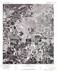
1975 Map of Shreveport West
USGS Topo · Published 1976About this map
Shreveport is seen here during a period of significant mid-1970s suburban expansion and infrastructural development. This orthophotomap, derived from 1975 aerial photography, reveals the dense residential patterns and industrial footprints that defined the western reaches of the city. The shoreline of Cross Lake dominates the northern portion of the sheet, providing a stark contrast between the natural water body and the rapidly developing urban grid. To the south, the settlement of Summer Grove appears as a distinct community focal point amidst the evolving landscape. The map's photographic nature captures specific land-use details, from the cleared tracts for new housing to the established commercial corridors and highway systems that connected these neighborhoods to the city's central core.
Find a feature on this map
3 named features on this map. Tap any name to fly to it.
Don’t see what you’re looking for? This feature index may not catch every label — zoom into the map to look around manually.
Map Details
Editions of this 1975 Shreveport West Map
This is the sole edition of this map. No revisions or reprints were ever made.
Other maps of this area

1932 · Bossier SW
USGS Topo · 1:31,680

1932 · Shreveport SE
USGS Topo · 1:31,680

1941 · Forbing
USGS Topo · 1:31,680

1945 · Greenwood
USGS Topo · 1:62,500

1948 · Mooringsport
USGS Topo · 1:62,500

1948 · Bossier City
USGS Topo · 1:62,500

1948 · Caspiana
USGS Topo · 1:62,500

1955 · Shreveport
USGS Topo · 1:250,000
1955 · Bossier City
USGS Topo · 1:24,000

1955 · Shreveport East
USGS Topo · 1:24,000