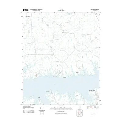
2012 Map of Shuford
USGS Topo · Published 2012About this map
Enid Lake dominates the southern portion of this landscape, its irregular shoreline reaching into the hills of Yalobusha County. The topography is defined by prominent rises like Chickasaw Hill, Oak Ridge, and Spyglass Hill, which overlook the expansive water. Small settlements and rural residential clusters are scattered throughout the northern reaches, including Shuford, Eureka Springs, and Lakeside. The area is notably dense with small family and community burial grounds, such as Pisgah Cem, Liberty Hill Cem, and Old Bynum Cem, suggesting a long-established rural population. Drainage systems like Hubbard Cr and Caney Cr feed into the reservoir, while a network of county roads like Pope Water Valley Rd and Cliff Finch Rd connect the isolated communities and shoreline access points like Water Valley Landing.
Find a feature on this map
75 named features on this map. Tap any name to fly to it.
Don’t see what you’re looking for? This feature index may not catch every label — zoom into the map to look around manually.
Map Details
Editions of this 2012 Shuford Map
This is the sole edition of this map. No revisions or reprints were ever made.
Other maps of this area

1940 · Oxford
USGS Topo · 1:62,500

1943 · Oxford
USGS Topo · 1:62,500

1952 · Sardis
USGS Topo · 1:62,500

1953 · Sardis
USGS Topo · 1:62,500

1954 · Oakland
USGS Topo · 1:62,500

1954 · Water Valley
USGS Topo · 1:62,500

1954 · Water Valley West
USGS Topo · 1:24,000

1955 · Water Valley
USGS Topo · 1:62,500

1956 · Tupelo
USGS Topo · 1:250,000

1958 · Tupelo
USGS Topo · 1:250,000