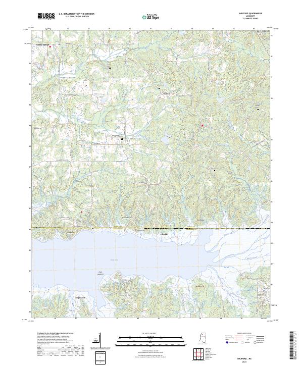
2024 Map of Shuford
USGS Topo · Published 2024About this map
Enid Lake dominates the southern landscape of this Panola and Yalobusha county boundary region, defining the local topography and settlement patterns. To the north, the terrain transitions into a network of creeks and ridges, where small communities like Shuford and Eureka Springs are connected by a web of rural roads such as Pope Water Valley Rd and Old Water Valley Rd. The area is notably dense with sites of genealogical interest, including several family and community burial grounds like Old Bynum Cem and Pisgah Cem. Local spiritual life centers around landmarks like the Liberty Hill Baptist Church, which sits alongside its own cemetery. Distinctive landforms such as Chickasaw Hill and Spyglass Hill rise above the drainage basins of Caney Creek and the Yocona River, providing a clear picture of the north-central Mississippi uplands.
Find a feature on this map
84 named features on this map. Tap any name to fly to it.
Don’t see what you’re looking for? This feature index may not catch every label — zoom into the map to look around manually.
Map Details
Editions of this 2024 Shuford Map
This is the sole edition of this map. No revisions or reprints were ever made.
Other maps of this area

1940 · Oxford
USGS Topo · 1:62,500

1943 · Oxford
USGS Topo · 1:62,500

1952 · Sardis
USGS Topo · 1:62,500

1953 · Sardis
USGS Topo · 1:62,500

1954 · Oakland
USGS Topo · 1:62,500

1954 · Water Valley
USGS Topo · 1:62,500

1954 · Water Valley West
USGS Topo · 1:24,000

1955 · Water Valley
USGS Topo · 1:62,500

1956 · Tupelo
USGS Topo · 1:250,000

1958 · Tupelo
USGS Topo · 1:250,000