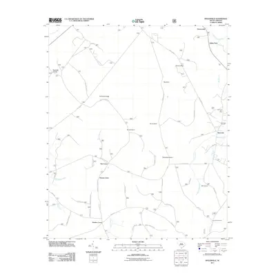
2011 Map of Shulerville
USGS Topo · Published 2011About this map
Shulerville anchors this coastal plain landscape, characterized by a distinct pattern of "corner" settlements and an intricate network of island-like terrain features surrounded by wetlands. The 2011 survey reveals the distribution of these small hubs, including Oak Corner, Thomas Corner, and Windom Corner, which likely evolved as high-ground junctions within the surrounding lowlands. The eastern edge of the map features the Shulerville Post Office and New Hope Cemetery, serving as local landmarks for genealogists and regional historians.
Find a feature on this map
56 named features on this map. Tap any name to fly to it.
Don’t see what you’re looking for? This feature index may not catch every label — zoom into the map to look around manually.
Map Details
Editions of this 2011 Shulerville Map
This is the sole edition of this map. No revisions or reprints were ever made.
Other maps of this area

1919 · Cordesville
USGS Topo · 1:48,000

1942 · Cedar Creek
USGS Topo · 1:24,000

1942 · Honey Hill
USGS Topo · 1:24,000

1943 · Shulerville
USGS Topo · 1:24,000

1943 · Jamestown
USGS Topo · 1:24,000

1943 · Awendaw
USGS Topo · 1:24,000

1943 · Ocean Bay
USGS Topo · 1:24,000

1943 · Bonneau
USGS Topo · 1:62,500

1948 · Bethera
USGS Topo · 1:24,000

1949 · Georgetown
USGS Topo · 1:250,000