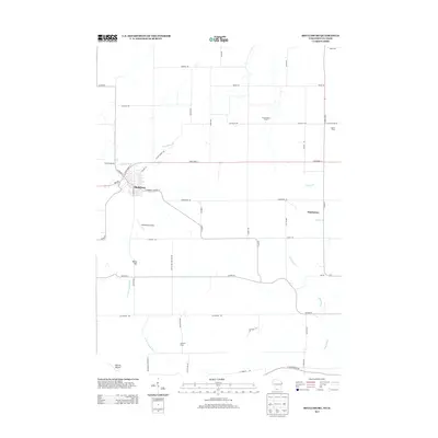
2013 Map of Shullsburg
USGS Topo · Published 2013About this map
Shullsburg serves as the primary hub in this corner of Lafayette County, where the street grid of S Judgement St and E Water St Co Hwy-A meets the arterial State Road 11. The surrounding landscape is defined by the headwaters of the Apple River and its W Fork Apple River, carving through the terrain near landmarks like White Hill and Charles Mound. Longstanding agricultural heritage is evident through named properties such as Teutschmann Farm, Upmann Farm, and Baxter Farm, reflecting the rural character that has persisted into the 21st century.
Find a feature on this map
56 named features on this map. Tap any name to fly to it.
Don’t see what you’re looking for? This feature index may not catch every label — zoom into the map to look around manually.
Map Details
Editions of this 2013 Shullsburg Map
This is the sole edition of this map. No revisions or reprints were ever made.
Other maps of this area

1902 · Mineral Point
USGS Topo · 1:125,000

1911 · Elizabeth
USGS Topo · 1:62,500

1911 · Galena
USGS Topo · 1:62,500

1913 · Galena
USGS Topo · 1:62,500

1936 · Elizabeth
USGS Topo · 1:62,500

1952 · Shullsburg
USGS Topo · 1:24,000

1952 · Calamine
USGS Topo · 1:24,000

1952 · Belmont
USGS Topo · 1:24,000

1952 · New Diggings
USGS Topo · 1:24,000

1959 · Dubuque
USGS Topo · 1:250,000