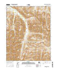
2016 Map of Shungnak B-3 SW
USGS Topo · Published 2016About this map
The high ridges of the Purcell Mountains dominate this 2016 survey of the Alaskan interior, where the Continental Divide traces a winding path through the rugged terrain of the Yukon-Koyukuk region. This map illustrates the stark, high-altitude landscape where the headwaters of regional drainages are separated by the spine of the continent. The lack of named settlements or man-made infrastructure emphasizes the wilderness character of the area, defined instead by the township and range grids of the Public Land Survey System, including t11n r7e and t10n r7e. For geologists and surveyors, the intricate contour intervals reveal the complex geomorphology of the western Brooks Range foothills before they descend into the lower river basins.
Find a feature on this map
8 named features on this map. Tap any name to fly to it.
Don’t see what you’re looking for? This feature index may not catch every label — zoom into the map to look around manually.
Map Details
Editions of this 2016 Shungnak B-3 SW Map
This is the sole edition of this map. No revisions or reprints were ever made.
Other maps of this area

1951 · Shungnak
USGS Topo · 1:250,000

1955 · Shungnak
USGS Topo · 1:250,000

1964 · Shungnak
USGS Topo · 1:250,000

1985 · Shungnak B-4
USGS Topo · 1:63,360
1985 · Shungnak A-3
USGS Topo · 1:63,360
1985 · Shungnak B-3
USGS Topo · 1:63,360
1985 · Shungnak A-4
USGS Topo · 1:63,360
2016 · Shungnak B-3 SE
USGS Topo · 1:25,000
2016 · Shungnak A-4 NE
USGS Topo · 1:25,000
2016 · Shungnak B-4 NE
USGS Topo · 1:25,000