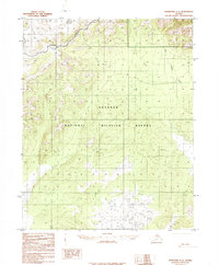
1985 Map of Shungnak A-4
USGS Topo · Published 1985About this map
The Continental Divide winds through this interior Alaskan landscape, marking a significant topographic transition within the Koyukuk National Wildlife Refuge. Based on 1971 aerial photography and edited in the mid-1980s, the map reveals a wilderness largely devoid of permanent settlements, defined instead by drainage patterns and remote peaks. Waterways like Billy Hawk Creek flow through the northern reaches, while a solitary Tractor Trail in the northeast corner provides the only evidence of overland mechanized travel across the tundra. Notable landmarks such as Bush and Octupus serve as primary points of orientation in a region dominated by elevation contours and seasonal wetlands. This provisional survey captures the territory as it was managed prior to further modern infrastructure, preserving the original hydrography and natural boundaries of the refuge.
Find a feature on this map
6 named features on this map. Tap any name to fly to it.
Don’t see what you’re looking for? This feature index may not catch every label — zoom into the map to look around manually.
Map Details
Editions of this 1985 Shungnak A-4 Map
This is the sole edition of this map. No revisions or reprints were ever made.
Other maps of this area

1951 · Shungnak
USGS Topo · 1:250,000

1951 · Kateel River
USGS Topo · 1:250,000

1954 · Kateel River D-3
USGS Topo · 1:63,360

1954 · Kateel River D-4
USGS Topo · 1:63,360

1954 · Kateel River D-5
USGS Topo · 1:63,360

1955 · Shungnak
USGS Topo · 1:250,000

1955 · Kateel River
USGS Topo · 1:250,000

1964 · Shungnak
USGS Topo · 1:250,000

1985 · Shungnak B-4
USGS Topo · 1:63,360
1985 · Shungnak A-3
USGS Topo · 1:63,360