
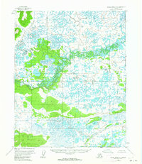
1954 Map of Kateel River D-3
USGS Topo · Published 1959About this map
The Huslia River snakes across this interior landscape, defining a complex corridor of oxbows and marshy lowlands typical of the Alaskan wilderness before statehood. The river's meandering course dominates the central and northern sections of the terrain, while the Nulima River cuts across the southeastern corner. This mid-century survey reveals a transition between dense wetland systems and slightly elevated ground, notably seen in the cluster of the Birch Lakes. Mapped from aerial photography taken in 1952 and field-annotated in 1954, the sheet captures a raw, unsettled environment with no roads or trails recorded, emphasizing the hydrological focus of early topographical work in the Yukon-Koyukuk region.
Find a feature on this map
3 named features on this map. Tap any name to fly to it.
Don’t see what you’re looking for? This feature index may not catch every label — zoom into the map to look around manually.
Map Details
Editions of this 1954 Kateel River D-3 Map
2 editions found
Other maps of this area

1951 · Shungnak
USGS Topo · 1:250,000

1951 · Kateel River
USGS Topo · 1:250,000

1954 · Kateel River C-4
USGS Topo · 1:63,360

1954 · Kateel River C-2
USGS Topo · 1:63,360

1954 · Kateel River C-3
USGS Topo · 1:63,360

1954 · Kateel River D-4
USGS Topo · 1:63,360

1955 · Shungnak
USGS Topo · 1:250,000

1955 · Kateel River D-2
USGS Topo · 1:63,360

1955 · Kateel River
USGS Topo · 1:250,000

1964 · Shungnak
USGS Topo · 1:250,000