
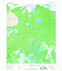
1954 Map of Kateel River C-3
USGS Topo · Published 1959About this map
The Koyukuk River winds through a landscape of shifting sands and complex waterways in this mid-century survey of the Alaskan interior. A standout feature is the Nogahabara Sand Dunes, a rare active dune field in the subarctic that dominates the western portion of the sheet. The river's dynamic nature is evident in the dramatic Colville Bend and the intricate channels of Three Day Slough. Human presence is sparse, marked primarily by the seasonal Winter Trail following the riverbank and the isolated Vincents Camp. The map provides a detailed look at the hydrology of the region, including the Nulitna River and Dagidli River, which feed into the broader valley floor characterized by marshes and the waters of Tachanlowa Lake.
Find a feature on this map
10 named features on this map. Tap any name to fly to it.
Don’t see what you’re looking for? This feature index may not catch every label — zoom into the map to look around manually.
Map Details
Editions of this 1954 Kateel River C-3 Map
2 editions found
Other maps of this area

1951 · Kateel River
USGS Topo · 1:250,000

1952 · Kateel River B-3
USGS Topo · 1:63,360

1952 · Kateel River B-2
USGS Topo · 1:63,360

1952 · Kateel River B-4
USGS Topo · 1:63,360

1954 · Kateel River C-4
USGS Topo · 1:63,360

1954 · Kateel River C-2
USGS Topo · 1:63,360

1954 · Kateel River D-3
USGS Topo · 1:63,360

1954 · Kateel River D-4
USGS Topo · 1:63,360

1955 · Kateel River D-2
USGS Topo · 1:63,360

1955 · Kateel River
USGS Topo · 1:250,000