
1952 Map of Kateel River B-3
USGS Topo · Published 1958About this map
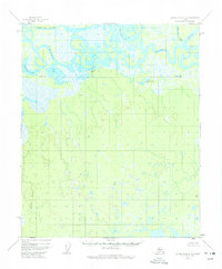
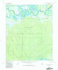
The Koyukuk River meanders across the northern portion of this interior Alaskan landscape, defining a complex system of oxbows and marshlands. This early 1950s survey captures a wilderness environment where human presence is sparse, marked only by isolated shelters such as a single Cabin along the river bend and a cluster of Cabins further downstream. These structures likely served as seasonal camps or trapper residences along the river's navigable reaches. To the north, the Three Day Slough parallels the main channel, while prominent water bodies like Tachanlowa Lake and Sam White Lake dominate the low-lying alluvial plains. The southern portion of the quadrangle rises toward higher ground, anchored by the VABM Pivot 335 survey point, providing a stark contrast to the saturated wetlands and the prominent Sand Bluff overlooking the river corridor.
Find a feature on this map
9 named features on this map. Tap any name to fly to it.
Don’t see what you’re looking for? This feature index may not catch every label — zoom into the map to look around manually.
Map Details
Editions of this 1952 Kateel River B-3 Map
3 editions found
Other maps of this area

1951 · Kateel River
USGS Topo · 1:250,000

1952 · Kateel River A-2
USGS Topo · 1:63,360

1952 · Kateel River A-4
USGS Topo · 1:63,360

1952 · Kateel River A-3
USGS Topo · 1:63,360

1952 · Kateel River B-2
USGS Topo · 1:63,360

1952 · Kateel River B-4
USGS Topo · 1:63,360

1954 · Kateel River C-4
USGS Topo · 1:63,360

1954 · Kateel River C-2
USGS Topo · 1:63,360

1954 · Kateel River C-3
USGS Topo · 1:63,360

1955 · Kateel River
USGS Topo · 1:250,000