
1954 Map of Kateel River D-4
USGS Topo · Published 1959About this map
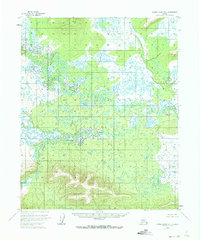
The Huslia River winds across this interior Alaskan landscape, characterized by a complex network of wetlands and small water bodies that dominate the central drainage. The terrain is marked by significant elevation points used for early aerial photogrammetric control, such as Vabm 1162 Shot and Vabm 777 Berry, which rise above the surrounding basin. In the southern portion of the map, the South Fork feeds into the main river system, creating a dense pattern of oxbows and seasonal ponds. This 1950s survey captures a wilderness area devoid of roads or permanent settlements, reflecting the remote nature of the Fourth Judicial Division before modern development or infrastructure reached this part of the Yukon-Koyukuk region.
Find a feature on this map
4 named features on this map. Tap any name to fly to it.
Don’t see what you’re looking for? This feature index may not catch every label — zoom into the map to look around manually.
Map Details
Editions of this 1954 Kateel River D-4 Map
2 editions found
Other maps of this area

1951 · Shungnak
USGS Topo · 1:250,000

1951 · Kateel River
USGS Topo · 1:250,000

1954 · Kateel River C-4
USGS Topo · 1:63,360

1954 · Kateel River C-3
USGS Topo · 1:63,360

1954 · Kateel River D-3
USGS Topo · 1:63,360

1954 · Kateel River D-5
USGS Topo · 1:63,360

1955 · Shungnak
USGS Topo · 1:250,000
1955 · Kateel River C-5
USGS Topo · 1:63,360

1955 · Kateel River
USGS Topo · 1:250,000

1964 · Shungnak
USGS Topo · 1:250,000