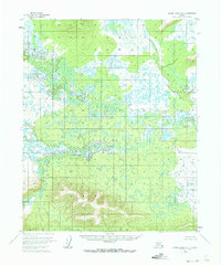
1954 Map of Kateel River D-4
USGS Topo · Published 1973About this map
The North Fork Huslia River meanders across this interior Alaska landscape, characterized by a complex network of wetlands and small lakes. Based on aerial photography from 1952 and field annotation in 1954, this survey documents a vast, undeveloped drainage basin before modern infrastructure reached this portion of the Yukon-Koyukuk region. The southern portion of the map is defined by the South Fork, where the terrain transitions from low-lying marshlands to more defined topographic contours. The absence of roads or established settlements on this sheet highlights the isolation of the Kateel River wilderness during the mid-twentieth century, offering a baseline for environmental researchers and those studying the natural hydrology of the Koyukuk River tributary system.
Find a feature on this map
2 named features on this map. Tap any name to fly to it.
Don’t see what you’re looking for? This feature index may not catch every label — zoom into the map to look around manually.
Map Details
Editions of this 1954 Kateel River D-4 Map
2 editions found
Other maps of this area

1951 · Shungnak
USGS Topo · 1:250,000

1951 · Kateel River
USGS Topo · 1:250,000

1954 · Kateel River C-4
USGS Topo · 1:63,360

1954 · Kateel River C-3
USGS Topo · 1:63,360

1954 · Kateel River D-3
USGS Topo · 1:63,360

1954 · Kateel River D-4
USGS Topo · 1:63,360

1954 · Kateel River D-5
USGS Topo · 1:63,360

1955 · Shungnak
USGS Topo · 1:250,000
1955 · Kateel River C-5
USGS Topo · 1:63,360

1955 · Kateel River
USGS Topo · 1:250,000