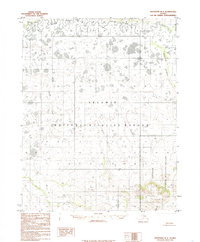
1985 Map of Shungnak B-5
USGS Topo · Published 1985About this map
The Selawik River meanders across the northern reaches of this landscape, anchoring a vast wetland environment defined by intricate hydrological patterns. Based on photography from 1971 and edited in the mid-1980s, this survey captures a significant portion of the Selawik National Wildlife Refuge, where the terrain is dominated by a dense network of lakes and marshes. To the southeast, the Koyukuk National Wildlife Refuge marks the transition toward more elevated ground. This shift in topography is most evident at Triplet 1823, a distinct relief point near the southern margin. Tributaries such as Kerulu Creek and Ingruksukruk Creek drain the surrounding tundra, illustrating the complex water drainage systems of this Arctic region before modern infrastructure changes. The map emphasizes the absence of roads, reflecting the preservation of this wilderness area for migratory birds and local ecosystems.
Find a feature on this map
6 named features on this map. Tap any name to fly to it.
Don’t see what you’re looking for? This feature index may not catch every label — zoom into the map to look around manually.
Map Details
Editions of this 1985 Shungnak B-5 Map
This is the sole edition of this map. No revisions or reprints were ever made.
Other maps of this area

1951 · Shungnak
USGS Topo · 1:250,000

1955 · Shungnak
USGS Topo · 1:250,000

1964 · Shungnak
USGS Topo · 1:250,000

1985 · Shungnak B-4
USGS Topo · 1:63,360
1985 · Shungnak B-6
USGS Topo · 1:63,360
1985 · Shungnak A-5
USGS Topo · 1:63,360
1985 · Shungnak A-6
USGS Topo · 1:63,360
1985 · Shungnak A-4
USGS Topo · 1:63,360
1985 · Shungnak C-6
USGS Topo · 1:63,360
1985 · Shungnak C-5
USGS Topo · 1:63,360