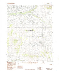
1985 Map of Shungnak C-5
USGS Topo · Published 1985About this map
Selawik National Wildlife Refuge encompasses the vast majority of this landscape in the Northwest Arctic, revealing a complex network of arctic waterways and wetlands as they were documented in the mid-1980s. The hydrology is dominated by the meandering course of the Selawik River which flows across the southern portion of the quadrangle. To the north, the Kugarak River and Rabbit River wind through low-lying terrain characterized by numerous small lakes and marshes. These river systems are central to the region's geography, providing critical habitat within the refuge boundaries. The Kawichiark River further defines the drainage patterns in the southwest, illustrating the untouched character of this roadless area. Compiled from 1971 aerial photography, the map reflects a wilderness environment where natural features remain the primary landmarks for navigation and land management.
Find a feature on this map
5 named features on this map. Tap any name to fly to it.
Don’t see what you’re looking for? This feature index may not catch every label — zoom into the map to look around manually.
Map Details
Editions of this 1985 Shungnak C-5 Map
This is the sole edition of this map. No revisions or reprints were ever made.
Other maps of this area

1951 · Shungnak
USGS Topo · 1:250,000

1955 · Shungnak
USGS Topo · 1:250,000

1955 · Shungnak D-4
USGS Topo · 1:63,360

1955 · Shungnak D-6
USGS Topo · 1:63,360

1955 · Shungnak D-5
USGS Topo · 1:63,360

1964 · Shungnak
USGS Topo · 1:250,000

1985 · Shungnak B-4
USGS Topo · 1:63,360
1985 · Shungnak B-6
USGS Topo · 1:63,360
1985 · Shungnak C-6
USGS Topo · 1:63,360
1985 · Shungnak B-5
USGS Topo · 1:63,360