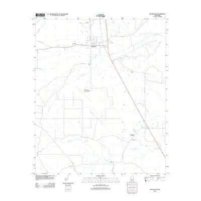
2012 Map of Shuqualak
USGS Topo · Published 2012About this map
The town of Shuqualak anchors the northern portion of this Noxubee County landscape, where the local street grid intersects with Hwy 145 and the railroad. To the south, the settlement of Wahalak sits near the confluence of several drainage systems, including Sid Cr and Wahalak Cr. This area is characterized by a high density of family and community burial grounds, such as Martin Cem, Slaughter Cem, and the Twin Cemeteries, which offer significant data points for genealogical research in this part of Mississippi.
Find a feature on this map
40 named features on this map. Tap any name to fly to it.
Don’t see what you’re looking for? This feature index may not catch every label — zoom into the map to look around manually.
Map Details
Editions of this 2012 Shuqualak Map
This is the sole edition of this map. No revisions or reprints were ever made.
Other maps of this area

1953 · Meridian
USGS Topo · 1:250,000

1953 · West Point
USGS Topo · 1:250,000

1957 · Meridian
USGS Topo · 1:250,000

1958 · West Point
USGS Topo · 1:250,000

1962 · Shuqualak
USGS Topo · 1:24,000

1963 · West Point
USGS Topo · 1:250,000

1963 · De Kalb
USGS Topo · 1:24,000

1963 · Townsend
USGS Topo · 1:24,000

1963 · Gholson
USGS Topo · 1:24,000

1965 · Meridian
USGS Topo · 1:250,000