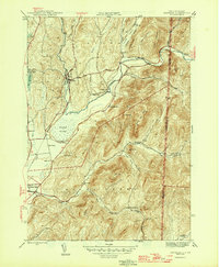
1946 Map of Shushan
USGS Topo · Published 1946About this map
Batten Kill winds through the hills of Washington County, anchoring a mid-century landscape defined by rural hamlets and valley agriculture. The community of Shushan serves as a focal point along the Delaware and Hudson railroad line, while smaller settlements like Eagleville and Anaquassacook are connected by a network of local roads. The terrain is marked by significant elevations such as Dugway Mountain and the ridge of Chestnut Woods, which overlook narrow valleys and hollows including Murray Hollow and McKie Hollow.
Find a feature on this map
46 named features on this map. Tap any name to fly to it.
Don’t see what you’re looking for? This feature index may not catch every label — zoom into the map to look around manually.
Map Details
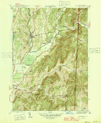
Editions of this 1946 Shushan Map
2 editions found
Other maps of this area

1894 · Equinox
USGS Topo · 1:62,500

1895 · Cambridge
USGS Topo · 1:62,500

1896 · Equinox
USGS Topo · 1:62,500

1897 · Hoosick
USGS Topo · 1:62,500

1898 · Cambridge
USGS Topo · 1:62,500

1898 · Bennington
USGS Topo · 1:62,500

1900 · Taconic
USGS Topo · 1:125,000

1900 · Equinox
USGS Topo · 1:62,500

1901 · Cambridge
USGS Topo · 1:62,500

1903 · Mettawee
USGS Topo · 1:125,000