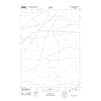
2012 Map of Shute Creek Lake
USGS Topo · Published 2012About this map
Emigrant Trl cuts across the northern reaches of this high desert terrain, marking a path through the same landscape that once guided westward travelers. This 2012 survey shows a network of seasonal and perennial waterways that define the local geography, including the meandering courses of Slate Cr and Shute Cr. The land is dominated by drainage systems, where small tributaries like Jackson Cr and Sheep Cr feed into larger basins. Near the center of this drainage network lies Shute Creek Lake, a distinctive landmark in an otherwise arid expanse. Modern infrastructure, represented by Co Rd 340 and other regional routes, now overlays the older paths of movement, illustrating the ongoing utility of these natural corridors for transportation and resource management in Lincoln County.
Find a feature on this map
7 named features on this map. Tap any name to fly to it.
Don’t see what you’re looking for? This feature index may not catch every label — zoom into the map to look around manually.
Map Details
Editions of this 2012 Shute Creek Lake Map
This is the sole edition of this map. No revisions or reprints were ever made.
Other maps of this area

1945 · Fort Hill
USGS Topo · 1:62,500

1947 · Fort Hill
USGS Topo · 1:62,500

1954 · Ogden
USGS Topo · 1:250,000

1955 · Preston
USGS Topo · 1:250,000

1958 · Ogden
USGS Topo · 1:250,000

1958 · Preston
USGS Topo · 1:250,000

1960 · Ogden
USGS Topo · 1:250,000

1962 · Preston
USGS Topo · 1:250,000

1968 · Fontenelle Reservoir SE
USGS Topo · 1:24,000

1968 · Fontenelle Reservoir SW
USGS Topo · 1:24,000