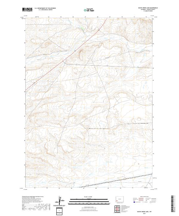
2021 Map of Shute Creek Lake
USGS Topo · Published 2021About this map
Shute Cr Lake sits at the heart of this high-desert basin in Lincoln County, where seasonal drainage patterns and historic pathways define the landscape. The drainage of Shute Cr and Slate Cr dominates the local topography, carving shallow courses across the terrain. Of particular interest to historical researchers is the Slate Creek Trl, which represents a modern cartographic record of a corridor long used for movement through this portion of Wyoming. The map provides a look at the section lines and township boundaries, including t23n r113w and t22n r112w, illustrating the geometric overlay of public land management against the natural meandering of smaller tributaries like Jackson Cr and Sheep Cr. Infrastructure is sparse, anchored by Co Rd 340 and highway 189, reflecting the region's enduring character as an open rangeland and resource area.
Find a feature on this map
11 named features on this map. Tap any name to fly to it.
Don’t see what you’re looking for? This feature index may not catch every label — zoom into the map to look around manually.
Map Details
Editions of this 2021 Shute Creek Lake Map
This is the sole edition of this map. No revisions or reprints were ever made.
Other maps of this area

1945 · Fort Hill
USGS Topo · 1:62,500

1947 · Fort Hill
USGS Topo · 1:62,500

1954 · Ogden
USGS Topo · 1:250,000

1955 · Preston
USGS Topo · 1:250,000

1958 · Ogden
USGS Topo · 1:250,000

1958 · Preston
USGS Topo · 1:250,000

1960 · Ogden
USGS Topo · 1:250,000

1962 · Preston
USGS Topo · 1:250,000

1968 · Fontenelle Reservoir SE
USGS Topo · 1:24,000

1968 · Fontenelle Reservoir SW
USGS Topo · 1:24,000