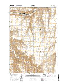
2017 Map of Shutler Flat
USGS Topo · Published 2017About this map
Olex sits at the southern edge of this landscape, where the terrain transitions toward the drainage of Rock Cr. This Gilliam County map reveals a high-plateau geography dominated by the expansive Shutler Flat, a broad tableland carved by several significant canyons. These topographic breaks, such as French Charlie Canyon and Juniper Canyon, define the rural character of the region. The transport network follows these natural contours and historical land divisions, with routes like Weatherford Rd and Bottemiller Ln connecting isolated homesteads across the townships of T1N R21E and T2N R21E. Water features are sparse but vital, represented by the winding course of E Fork Shutler Cr as it makes its way north through the plateau towards the Columbia River basin.
Find a feature on this map
20 named features on this map. Tap any name to fly to it.
Don’t see what you’re looking for? This feature index may not catch every label — zoom into the map to look around manually.
Map Details
Editions of this 2017 Shutler Flat Map
This is the sole edition of this map. No revisions or reprints were ever made.
Other maps of this area

1916 · Arlington
USGS Topo · 1:125,000

1916 · Condon
USGS Topo · 1:125,000

1953 · The Dalles
USGS Topo · 1:250,000

1956 · The Dalles
USGS Topo · 1:250,000

1957 · The Dalles
USGS Topo · 1:250,000

1964 · Turner Butte
USGS Topo · 1:24,000

1964 · Shutler Flat
USGS Topo · 1:24,000

1964 · Hickland Butte
USGS Topo · 1:24,000
1964 · Horn Butte
USGS Topo · 1:24,000

1970 · Devils Backbone
USGS Topo · 1:24,000