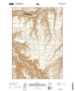
2020 Map of Shutler Flat
USGS Topo · Published 2020About this map
Shutler Flat and the small settlement of Olex anchor this 2020 map of Gilliam County, Oregon, revealing a landscape defined by deeply incised drainage systems. The plateau is carved by numerous canyons, including French Charlie Canyon, Cow Canyon, and Juniper Canyon, which descend toward the primary watercourses of Rock Cr and Alkali Canyon. A network of named rural roads, such as Weatherford Rd, Bottemiller Ln, and Old Tree Rd, follows the section lines and topography of the high desert. This survey provides a modern view of the enduring agricultural and ranching infrastructure in North Central Oregon, illustrating how the path of E Fork Shutler Cr and the surrounding coulees shape the local transport and settlement patterns.
Find a feature on this map
22 named features on this map. Tap any name to fly to it.
Don’t see what you’re looking for? This feature index may not catch every label — zoom into the map to look around manually.
Map Details
Editions of this 2020 Shutler Flat Map
This is the sole edition of this map. No revisions or reprints were ever made.
Other maps of this area

1916 · Arlington
USGS Topo · 1:125,000

1916 · Condon
USGS Topo · 1:125,000

1953 · The Dalles
USGS Topo · 1:250,000

1956 · The Dalles
USGS Topo · 1:250,000

1957 · The Dalles
USGS Topo · 1:250,000

1964 · Turner Butte
USGS Topo · 1:24,000

1964 · Shutler Flat
USGS Topo · 1:24,000

1964 · Hickland Butte
USGS Topo · 1:24,000
1964 · Horn Butte
USGS Topo · 1:24,000

1970 · Devils Backbone
USGS Topo · 1:24,000