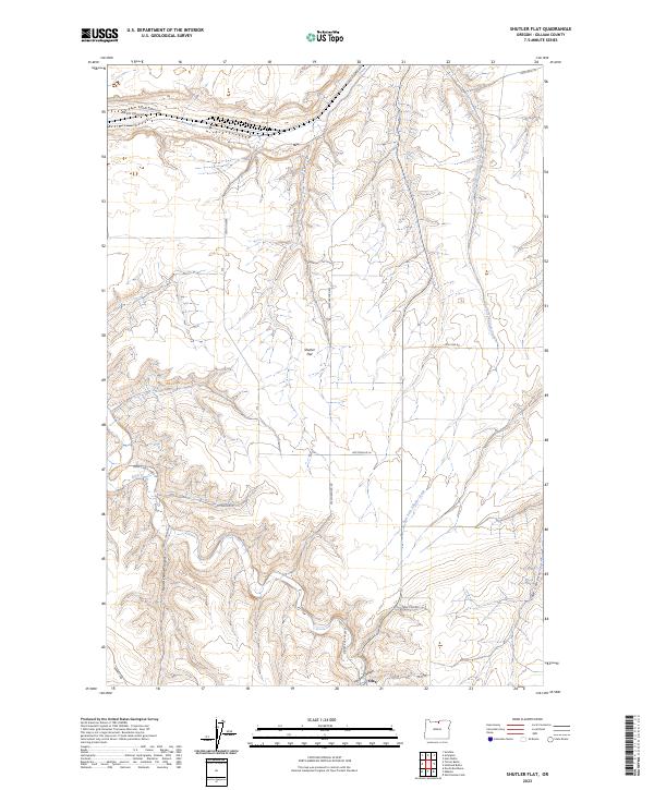
2023 Map of Shutler Flat
USGS Topo · Published 2023About this map
Olex and the broad upland of Shutler Flat define this landscape in the dry canyon country of Gilliam County. The terrain is deeply incised by a network of drainages, most notably Rock Creek and its tributary, East Fork Shutler Creek. These watercourses carve through the plateau, creating distinctive features such as French Charlie Canyon and Juniper Canyon. A grid of rural routes provides access to the high ground and canyon floors, with names like French Charlie Rd and Weatherford Rd hinting at the local families who established these ranchlands.
Find a feature on this map
24 named features on this map. Tap any name to fly to it.
Don’t see what you’re looking for? This feature index may not catch every label — zoom into the map to look around manually.
Map Details
Editions of this 2023 Shutler Flat Map
This is the sole edition of this map. No revisions or reprints were ever made.
Other maps of this area

1916 · Arlington
USGS Topo · 1:125,000

1916 · Condon
USGS Topo · 1:125,000

1953 · The Dalles
USGS Topo · 1:250,000

1956 · The Dalles
USGS Topo · 1:250,000

1957 · The Dalles
USGS Topo · 1:250,000

1964 · Turner Butte
USGS Topo · 1:24,000

1964 · Shutler Flat
USGS Topo · 1:24,000

1964 · Hickland Butte
USGS Topo · 1:24,000
1964 · Horn Butte
USGS Topo · 1:24,000

1970 · Devils Backbone
USGS Topo · 1:24,000