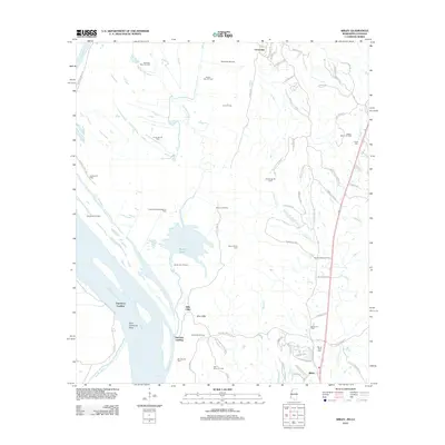
2012 Map of Sibley
USGS Topo · Published 2012About this map
Ellis Cliffs and the rugged eastern bank of the Mississippi River anchor this 2012 survey of Adams County. The landscape is defined by the legacy of river commerce at Hutchins Landing and Esperance Landing, alongside a massive network of petroleum extraction that includes the Carthage Point Oil Field and the Beverly Oil Field. This modern look at the region reveals how historic plantation boundaries have evolved into a network of residential and access roads, such as Brighton Plantation Rd and Ellislie Plantation Rd. Inland, the settlement of Sibley serves as a local hub near Mount Olive Cem, while the hydrology of the area is dominated by Butler Lake and the winding course of Old Saint Catherine Cr. The map documents a complex overlay of traditional river-bottom geography and intensive energy production.
Find a feature on this map
76 named features on this map. Tap any name to fly to it.
Don’t see what you’re looking for? This feature index may not catch every label — zoom into the map to look around manually.
Map Details
Editions of this 2012 Sibley Map
This is the sole edition of this map. No revisions or reprints were ever made.
Other maps of this area

1909 · Sycamore Landing
USGS Topo · 1:24,000

1909 · Vidalia
USGS Topo · 1:24,000

1921 · Natchez
USGS Topo · 1:48,000

1922 · Natchez
USGS Topo · 1:62,500

1939 · Red Gum
USGS Topo · 1:62,500

1939 · Natchez
USGS Topo · 1:62,500

1939 · Kingston
USGS Topo · 1:62,500

1939 · Deer Park
USGS Topo · 1:62,500

1953 · Natchez
USGS Topo · 1:250,000

1956 · Natchez
USGS Topo · 1:250,000