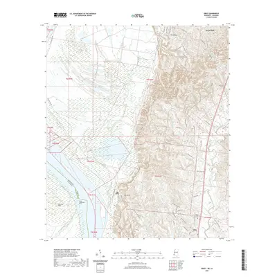
2020 Map of Sibley
USGS Topo · Published 2020About this map
Sibley and Cloverdale anchor this landscape along the eastern banks of the Mississippi River south of Natchez. The terrain is defined by the dramatic Ellis Cliffs and an intricate network of waterways, including the winding Old Saint Catherine Creek and the oxbow-like Willow Lake. The map reveals a transition from the river bottomlands to the rising loess bluffs, where numerous plantation-era road names like Glen Aubin Plantation Rd and Brighton Plantation Rd hint at the area's agricultural history. Local family and community roots are evident in the placement of Mount Olive Cem and Forest Cem. This 2020 survey documents the modern layout of rural Adams County, tracing the way contemporary roads like Lower Woodville Rd and Carthage Point Rd navigate a landscape still shaped by the shifting course of the great river and its tributaries like Robins Bayou and Hutchins Cr.
Find a feature on this map
61 named features on this map. Tap any name to fly to it.
Don’t see what you’re looking for? This feature index may not catch every label — zoom into the map to look around manually.
Map Details
Editions of this 2020 Sibley Map
This is the sole edition of this map. No revisions or reprints were ever made.
Other maps of this area

1909 · Sycamore Landing
USGS Topo · 1:24,000

1909 · Vidalia
USGS Topo · 1:24,000

1921 · Natchez
USGS Topo · 1:48,000

1922 · Natchez
USGS Topo · 1:62,500

1939 · Red Gum
USGS Topo · 1:62,500

1939 · Natchez
USGS Topo · 1:62,500

1939 · Kingston
USGS Topo · 1:62,500

1939 · Deer Park
USGS Topo · 1:62,500

1953 · Natchez
USGS Topo · 1:250,000

1956 · Natchez
USGS Topo · 1:250,000