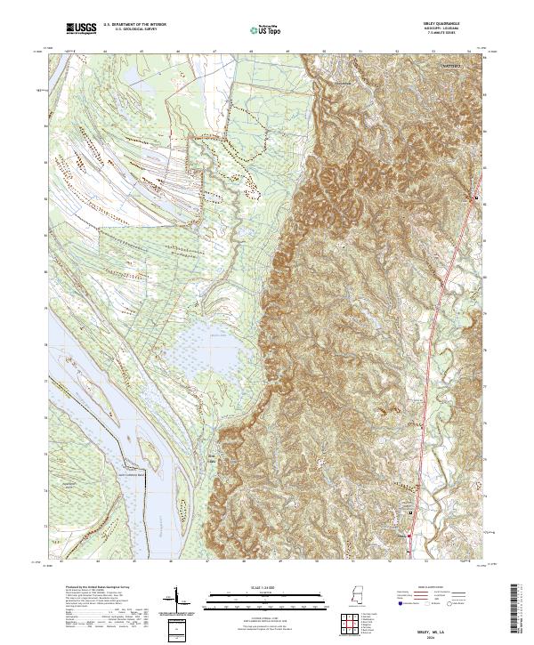
2024 Map of Sibley
USGS Topo · Published 2024About this map
Saint Catherine Creek National Wildlife Refuge dominates the lowlands of Adams County along the Mississippi River, showcasing the complex hydrological patterns of the alluvial plain. The map traces the remnants of former river paths at Saint Catherine Bend and Old Saint Catherine Creek, where the landscape transitions from wetlands and lakes like Butler Lake into the sharp elevation changes of Ellis Cliffs.
Find a feature on this map
66 named features on this map. Tap any name to fly to it.
Don’t see what you’re looking for? This feature index may not catch every label — zoom into the map to look around manually.
Map Details
Editions of this 2024 Sibley Map
This is the sole edition of this map. No revisions or reprints were ever made.
Other maps of this area

1909 · Sycamore Landing
USGS Topo · 1:24,000

1909 · Vidalia
USGS Topo · 1:24,000

1921 · Natchez
USGS Topo · 1:48,000

1922 · Natchez
USGS Topo · 1:62,500

1939 · Red Gum
USGS Topo · 1:62,500

1939 · Natchez
USGS Topo · 1:62,500

1939 · Kingston
USGS Topo · 1:62,500

1939 · Deer Park
USGS Topo · 1:62,500

1953 · Natchez
USGS Topo · 1:250,000

1956 · Natchez
USGS Topo · 1:250,000