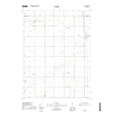
2018 Map of Sibley
USGS Topo · Published 2018About this map
Sibley sits at the intersection of rural heritage and prairie waterways in this 21st-century documentation of the Illinois landscape. Positioned near the headwaters of the Mackinaw River, the area is defined by a grid of agricultural roads that cross the borders of Ford, McLean, and Livingston counties. The village of Sibley is anchored by Lake Sibley, while the smaller settlements of Cropsey and Garber are situated along the regional transportation corridors.
Find a feature on this map
39 named features on this map. Tap any name to fly to it.
Don’t see what you’re looking for? This feature index may not catch every label — zoom into the map to look around manually.
Map Details
Editions of this 2018 Sibley Map
This is the sole edition of this map. No revisions or reprints were ever made.
Other maps of this area

1928 · Gibson City
USGS Topo · 1:62,500

1947 · Sibley
USGS Topo · 1:62,500

1949 · Sibley
USGS Topo · 1:62,500

1952 · Arrowsmith
USGS Topo · 1:62,500

1957 · Gibson City
USGS Topo · 1:62,500

1957 · Colfax
USGS Topo · 1:62,500

1958 · Peoria
USGS Topo · 1:250,000

1961 · Peoria
USGS Topo · 1:250,000

1963 · Peoria
USGS Topo · 1:250,000
1982 · Gibson City West
USGS Topo · 1:24,000