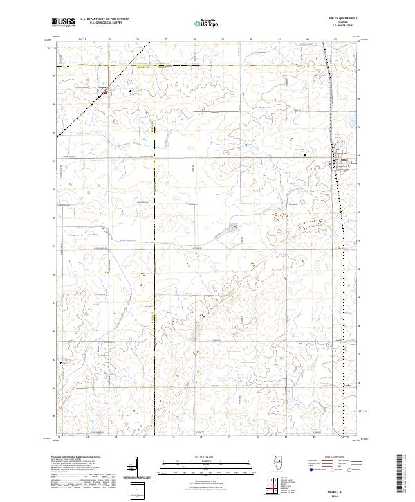
2024 Map of Sibley
USGS Topo · Published 2024About this map
Sibley sits at the heart of this prairie landscape, where the borders of McLean, Livingston, and Ford counties converge. This contemporary survey of the region illustrates a highly organized agricultural grid defined by a network of rural roads such as Co Rd 2100 N and E 1500N Rd. The terrain is drained by the winding Mackinaw River and its tributaries, including Henline Creek and Indian Creek, which break the geometric precision of the section lines. Local history and genealogy are anchored by several established landmarks, including Mount Hope Cem near Sibley and the Saint Johns Lutheran Cem to the south. Small settlements like Cropsey and the junction at Garber remain as vital focal points for the surrounding rural community, while Lake Sibley provides a distinct water feature on the eastern edge of the village.
Find a feature on this map
37 named features on this map. Tap any name to fly to it.
Don’t see what you’re looking for? This feature index may not catch every label — zoom into the map to look around manually.
Map Details
Editions of this 2024 Sibley Map
This is the sole edition of this map. No revisions or reprints were ever made.
Other maps of this area

1928 · Gibson City
USGS Topo · 1:62,500

1947 · Sibley
USGS Topo · 1:62,500

1949 · Sibley
USGS Topo · 1:62,500

1952 · Arrowsmith
USGS Topo · 1:62,500

1957 · Gibson City
USGS Topo · 1:62,500

1957 · Colfax
USGS Topo · 1:62,500

1958 · Peoria
USGS Topo · 1:250,000

1961 · Peoria
USGS Topo · 1:250,000

1963 · Peoria
USGS Topo · 1:250,000
1982 · Gibson City West
USGS Topo · 1:24,000