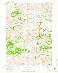
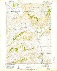
1961 Map of Sibley Peak
USGS Topo · Published 1965About this map
The historical transit corridors of the Emigrant Trail and the Chicago and North Western Railroad intersect this landscape, marking the evolution of Wyoming's transport routes from wagon ruts to iron rails. Near the rail line, an Oregon Trail Marker and the Pony Express Sta stand as landmarks to the region's westward expansion history. The terrain is defined by prominent elevations such as Sibley Peak and Anvil Peak, while water resources like the Glendo Reservoir and Downey Reservoir Number One highlight the development of the Missouri River Basin. Local family names are anchored to the land at Sommers Hill and Sommers Draw, providing specific points of interest for genealogists. The presence of the Horseshoe Cem and scattered Spring sites further illustrates the thin but deliberate settlement pattern typical of Platte County’s high plains during this era.
Find a feature on this map
29 named features on this map. Tap any name to fly to it.
Don’t see what you’re looking for? This feature index may not catch every label — zoom into the map to look around manually.
Map Details
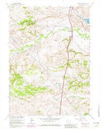
Editions of this 1961 Sibley Peak Map
2 editions found
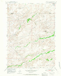
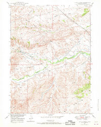
Other maps of this area

1896 · Hartville
USGS Topo · 1:125,000

1901 · Hartville
USGS Topo · 1:125,000
1949 · Cedar Hill
USGS Topo · 1:24,000
1949 · Spring Creek
USGS Topo · 1:24,000
1950 · Glendo
USGS Topo · 1:24,000

1950 · Spring Creek
USGS Topo · 1:24,000

1950 · Jewel Springs
USGS Topo · 1:24,000
1950 · Coleman Butte
USGS Topo · 1:24,000
1950 · Herman Ranch
USGS Topo · 1:24,000
1950 · Cottonwood Falls
USGS Topo · 1:24,000