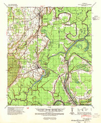
1941 Map of Sicily Island
USGS Topo · Published 1954About this map
Sicily Island rises as a prominent topographic feature within the alluvial lowlands of the Mississippi River basin, defined by the winding courses of the Tensas River and Bayou Macon. This 1941 edition, prepared by the Corps of Engineers and the Mississippi River Commission, details a landscape shaped by water and transport, where the Missouri Pacific railroad cuts through the terrain near settlements like Wisner and Foules. The map reveals the critical importance of river access through numerous named landings such as Eltringham Ldg and Crescent Ldg, and river crossings like Kirks Ferry. Notable for genealogists are the rural community hubs including Newlite Ch, Mitchell Sch, and an Indian Mound, reflecting both the historic and prehistoric human imprint on the Catahoula and Franklin Parish borderlands during the early 1940s.
Find a feature on this map
91 named features on this map. Tap any name to fly to it.
Don’t see what you’re looking for? This feature index may not catch every label — zoom into the map to look around manually.
Map Details
Editions of this 1941 Sicily Island Map
2 editions found
Other maps of this area

1921 · Natchez
USGS Topo · 1:48,000

1922 · Natchez
USGS Topo · 1:62,500

1935 · Winnsboro
USGS Topo · 1:62,500

1935 · Shackleford Lake
USGS Topo · 1:62,500

1939 · Red Gum
USGS Topo · 1:62,500

1939 · Fort Necessity
USGS Topo · 1:62,500

1939 · Natchez
USGS Topo · 1:62,500

1939 · Locust Ridge
USGS Topo · 1:62,500

1941 · Manifest
USGS Topo · 1:62,500

1941 · Sicily Island
USGS Topo · 1:62,500