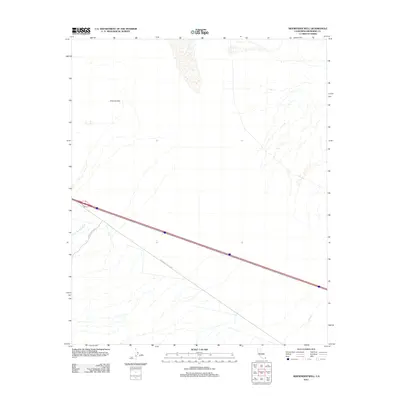
2012 Map of Sidewinder Well
USGS Topo · Published 2012About this map
Sidewinder Well stands as a primary landmark in this arid stretch of the Colorado Desert, where the landscape is defined by extensive desert washes and seasonal drainages. Modern infrastructure cuts across this remote terrain, dominated by the path of Interstate 10 and the older Chuckwalla Valley Rd slicing through the valley. The map details the hydrology of the region, including the broad Corn Springs Wash in the west and Ship Cr to the southeast, illustrating how water travels through this environment after infrequent rains. These landmarks provide a geographical context for the transit corridors that have historically connected the Coachella Valley with the eastern desert regions, tracing paths shaped by the natural topography of the Chuckwalla Mountains and surrounding desert flats.
Find a feature on this map
5 named features on this map. Tap any name to fly to it.
Don’t see what you’re looking for? This feature index may not catch every label — zoom into the map to look around manually.
Map Details
Editions of this 2012 Sidewinder Well Map
This is the sole edition of this map. No revisions or reprints were ever made.
Other maps of this area

1943 · Coxcomb Mountains
USGS Topo · 1:62,500

1944 · Chuckwalla Mountains
USGS Topo · 1:62,500

1944 · Coxcomb Mountains
USGS Topo · 1:62,500

1952 · Sidewinder Well
USGS Topo · 1:62,500

1952 · Palen Mountains
USGS Topo · 1:62,500

1954 · Salton Sea
USGS Topo · 1:250,000

1955 · Salton Sea
USGS Topo · 1:250,000

1959 · Salton Sea
USGS Topo · 1:250,000

1963 · Salton Sea
USGS Topo · 1:250,000

1963 · Chuckwalla Mountains
USGS Topo · 1:62,500