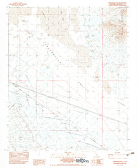
1983 Map of Sidewinder Well
USGS Topo · Published 1983About this map
Chuckwalla Valley and the Palen Mountains dominate this arid landscape in Riverside County, recorded during a 1978 field check. The area is defined by a series of critical infrastructure and water-access points, most notably the Sidewinder Well (Site) and Aztec Well. These sites, along with the Aztec Well Az, indicate the historical importance of groundwater in this desert region. Extensive engineering is visible through the Doublewood Pole Power Line, a Borrow Pit, and a network of protection structures including the Sidewinder Dike and Diversion Dike. The topography is a mix of vast Sand Dunes, dry washes, and several depressions, including the intermittent Palen Lake. Narrow corridors such as Ship Creek and numerous 5 Jeep trails provide the only passage through this remote basin, which is also traversed by 3 UG Gas Lines.
Find a feature on this map
18 named features on this map. Tap any name to fly to it.
Don’t see what you’re looking for? This feature index may not catch every label — zoom into the map to look around manually.
Map Details
Editions of this 1983 Sidewinder Well Map
This is the sole edition of this map. No revisions or reprints were ever made.
Other maps of this area

1943 · Coxcomb Mountains
USGS Topo · 1:62,500

1944 · Chuckwalla Mountains
USGS Topo · 1:62,500

1944 · Coxcomb Mountains
USGS Topo · 1:62,500

1952 · Sidewinder Well
USGS Topo · 1:62,500

1952 · Palen Mountains
USGS Topo · 1:62,500

1954 · Salton Sea
USGS Topo · 1:250,000

1955 · Salton Sea
USGS Topo · 1:250,000

1959 · Salton Sea
USGS Topo · 1:250,000

1963 · Salton Sea
USGS Topo · 1:250,000

1963 · Chuckwalla Mountains
USGS Topo · 1:62,500