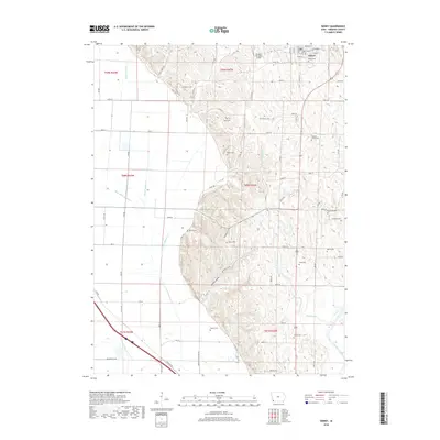
2018 Map of Sidney
USGS Topo · Published 2018About this map
Sidney serves as the focal point of this Fremont County landscape, its grid of streets including Cass St and Douglas St situated atop the high ground before the terrain drops into the bottomlands to the west. The map reveals an exceptionally dense distribution of family and community burial grounds across the loess hills, from Sidney Cem at the town's edge to the more remote Lovelady Cem and Means Cem to the south. This concentration of rural cemeteries suggests a long-established pattern of family homesteads throughout the region. To the west, the landscape is defined by an extensive drainage network designed for agriculture, featuring Main Ditch Number 6, Lateral Number 8, and Lateral Number 10. These man-made channels contrast with the natural winding course of the Nishnabotna River in the southeast and the seasonal flow through Militia Hollow.
Find a feature on this map
86 named features on this map. Tap any name to fly to it.
Don’t see what you’re looking for? This feature index may not catch every label — zoom into the map to look around manually.
Map Details
Editions of this 2018 Sidney Map
This is the sole edition of this map. No revisions or reprints were ever made.
Other maps of this area

1907 · Nebraska City
USGS Topo · 1:62,500

1935 · Nehawka
USGS Topo · 1:48,000

1939 · Hamburg
USGS Topo · 1:62,500

1940 · Nehawka
USGS Topo · 1:62,500

1941 · Hamburg
USGS Topo · 1:62,500

1955 · Nebraska City
USGS Topo · 1:250,000

1957 · Nebraska City
USGS Topo · 1:250,000

1957 · Randolph
USGS Topo · 1:24,000

1957 · Tabor SW
USGS Topo · 1:24,000

1958 · Nebraska City
USGS Topo · 1:250,000