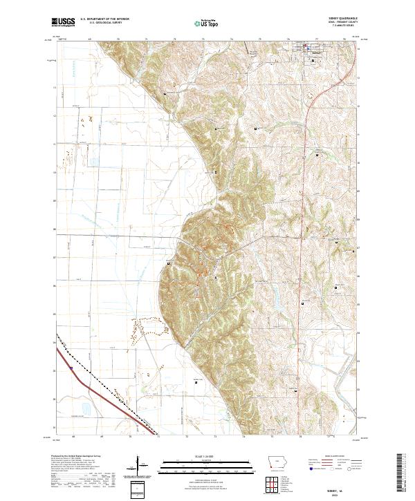
2022 Map of Sidney
USGS Topo · Published 2022About this map
Sidney serves as the focal point of this Fremont County landscape, situated atop the loess hills east of the expansive Missouri River floodplain. The town's grid is anchored by the Fremont County Courthouse, with local history etched into numerous rural burial grounds such as Knox Cem, Rector Cem, and Slusher Cem. The geography is defined by a sharp transition from the flat, ditch-drained bottomlands to the west—traversed by Main Ditch Number 6 and Lateral Number 8—to the elevated, dissected terrain of the uplands. This rise is marked by landmarks like Militia Hollow and the Paradise Mountain Airport. To the southeast, the Nishnabotna River meanders through the corner of the survey, while the western lowlands are managed by an extensive drainage network including Horse Cr Ditch. Local family names are preserved through features like Lovelady Cem and Austin Cem, reflecting the area's deep agricultural roots.
Find a feature on this map
62 named features on this map. Tap any name to fly to it.
Don’t see what you’re looking for? This feature index may not catch every label — zoom into the map to look around manually.
Map Details
Editions of this 2022 Sidney Map
This is the sole edition of this map. No revisions or reprints were ever made.
Other maps of this area

1907 · Nebraska City
USGS Topo · 1:62,500

1935 · Nehawka
USGS Topo · 1:48,000

1939 · Hamburg
USGS Topo · 1:62,500

1940 · Nehawka
USGS Topo · 1:62,500

1941 · Hamburg
USGS Topo · 1:62,500

1955 · Nebraska City
USGS Topo · 1:250,000

1957 · Nebraska City
USGS Topo · 1:250,000

1957 · Randolph
USGS Topo · 1:24,000

1957 · Tabor SW
USGS Topo · 1:24,000

1958 · Nebraska City
USGS Topo · 1:250,000