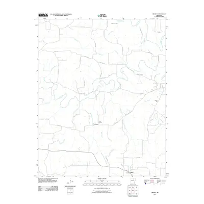
2011 Map of Sidney
USGS Topo · Published 2011About this map
Sidney sits near the southern edge of this Sharp County landscape, serving as a focal point for the surrounding rural network of farms and creek valleys. The settlement pattern is defined by the winding paths of the Strawberry River and its numerous tributaries, including Piney Fork and Bear Creek. The geography here is notably intersected by branches named for local landmarks, such as Hamms Schoolhouse Branch and Mudtown Branch, reflecting a community deeply tied to its water sources and small-scale land divisions.
Find a feature on this map
62 named features on this map. Tap any name to fly to it.
Don’t see what you’re looking for? This feature index may not catch every label — zoom into the map to look around manually.
Map Details
Editions of this 2011 Sidney Map
This is the sole edition of this map. No revisions or reprints were ever made.
Other maps of this area

1890 · Batesville
USGS Topo · 1:125,000

1891 · Batesville
USGS Topo · 1:125,000

1942 · Mt Pleasant
USGS Topo · 1:31,680

1943 · Sandtown
USGS Topo · 1:24,000

1943 · Cave City
USGS Topo · 1:31,680

1951 · Melbourne
USGS Topo · 1:62,500

1953 · Memphis
USGS Topo · 1:250,000

1956 · Memphis
USGS Topo · 1:250,000

1957 · Poplar Bluff
USGS Topo · 1:250,000

1959 · Poplar Bluff
USGS Topo · 1:250,000