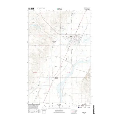
2017 Map of Sidney
USGS Topo · Published 2017About this map
The Yellowstone River snakes through the eastern plains of Richland County, defining the agricultural and transport infrastructure of this Montana region. The city of Sidney serves as the primary hub, where a dense grid of streets like W Main St and E Holly St meets the Main Canal, a vital irrigation artery supporting the surrounding sugar beet and grain country. The landscape is a mix of flat river bottomlands and rising coulees, such as Spring Coulee and Youngs Coulee, that drain toward the river valley.
Find a feature on this map
51 named features on this map. Tap any name to fly to it.
Don’t see what you’re looking for? This feature index may not catch every label — zoom into the map to look around manually.
Map Details
Editions of this 2017 Sidney Map
This is the sole edition of this map. No revisions or reprints were ever made.
Other maps of this area

1909 · Glendive
USGS Topo · 1:250,000

1954 · Glendive
USGS Topo · 1:250,000

1957 · Glendive
USGS Topo · 1:250,000

1958 · Glendive
USGS Topo · 1:250,000

1966 · Crane NE
USGS Topo · 1:24,000

1966 · Piche
USGS Topo · 1:24,000

1966 · Crane
USGS Topo · 1:24,000

1966 · Sidney NE
USGS Topo · 1:24,000

1966 · Sidney
USGS Topo · 1:24,000

1972 · Brorson
USGS Topo · 1:24,000