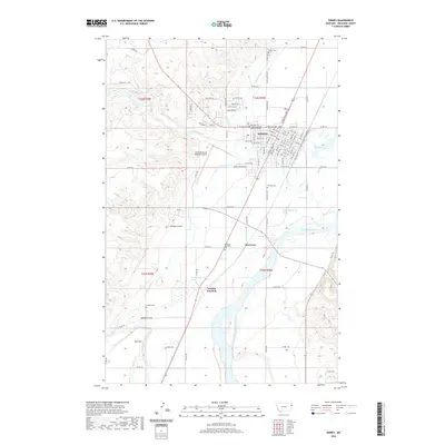
2020 Map of Sidney
USGS Topo · Published 2020About this map
The Yellowstone River winds through the eastern edge of this landscape, anchoring a region defined by extensive irrigation and transportation networks in Richland County. Sidney serves as the primary hub, showing a detailed street grid including W Main St, E Main St, and various residential lanes like Bitterroot Dr and Sage Lily Dr. The map illustrates the town's administrative role through the Richland County Law and Justice Center and connectivity provided by the Sidney-Richland Regional Airport. To the south, smaller communities and junctions such as Riverview and Newlon Junction appear along the river valley. The agricultural development of the area is evident in the presence of the Main Canal, which cuts across the terrain to support local farms. Several historic burial sites, including Sidney Cem, Pioneer Cem, and Newlon Cem, provide valuable data points for genealogists tracing family roots in this corner of Montana.
Find a feature on this map
47 named features on this map. Tap any name to fly to it.
Don’t see what you’re looking for? This feature index may not catch every label — zoom into the map to look around manually.
Map Details
Editions of this 2020 Sidney Map
This is the sole edition of this map. No revisions or reprints were ever made.
Other maps of this area

1909 · Glendive
USGS Topo · 1:250,000

1954 · Glendive
USGS Topo · 1:250,000

1957 · Glendive
USGS Topo · 1:250,000

1958 · Glendive
USGS Topo · 1:250,000

1966 · Crane NE
USGS Topo · 1:24,000

1966 · Piche
USGS Topo · 1:24,000

1966 · Crane
USGS Topo · 1:24,000

1966 · Sidney NE
USGS Topo · 1:24,000

1966 · Sidney
USGS Topo · 1:24,000

1972 · Brorson
USGS Topo · 1:24,000