1895 Map of Sierra Blanca
USGS Topo · Published 1907About this map
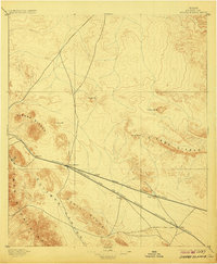
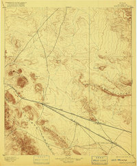
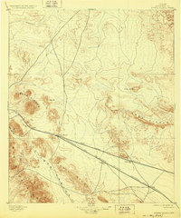
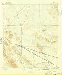
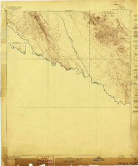
Trans-Pecos rail infrastructure serves as the backbone of this late nineteenth-century survey, centered on the strategic junction at Sierra Blanca. The settlement patterns here are dictated entirely by the iron rail, with a string of depots and watering stops including Etholen, Arispe, and Grayton positioned along the corridor. The intersection of the Galveston Harrisburg and San Antonio Railroad and the Texas and Pacific Railroad highlights the region's importance as a continental gateway during the peak of western rail expansion.
Find a feature on this map
19 named features on this map. Tap any name to fly to it.
Don’t see what you’re looking for? This feature index may not catch every label — zoom into the map to look around manually.
Map Details
Editions of this 1895 Sierra Blanca Map
5 editions found
Other maps of this area

1892 · Chispa
USGS Topo · 1:125,000

1894 · Fort Hancock
USGS Topo · 1:125,000

1895 · Chispa
USGS Topo · 1:125,000

1895 · Sierra Blanca
USGS Topo · 1:125,000
1897 · Eagle Mountain
USGS Topo · 1:125,000

1897 · Chispa
USGS Topo · 1:125,000

1903 · Cerro Alto
USGS Topo · 1:125,000

1906 · Van Horn
USGS Topo · 1:125,000

1916 · Eagle Mountain
USGS Topo · 1:125,000

1943 · Fort Quitman
USGS Topo · 1:62,500