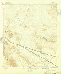
1895 Map of Sierra Blanca
USGS Topo · Published 1949About this map
Sierra Blanca serves as the focal point of this High Desert landscape, where the convergence of major rail lines defined the region's late-nineteenth-century development. The Texas and Pacific Railroad and the Galveston Harrisburg and San Antonio Railroad parallel each other across the arid terrain, supporting a string of small stop-points like Etholen, Arispe, and Eagle Flat. The topography is dominated by isolated peaks and massive ridges, including the Quitman Mountains and the prominent Devil Ridge. Surveyed in the early 1890s, the map illustrates a landscape of extreme relief, from Dome Peak to the broad expanse of the Salt Basin, where water sources like the S.P. Well were critical for steam locomotives and the few established ranching outposts in this part of Hudspeth County.
Find a feature on this map
18 named features on this map. Tap any name to fly to it.
Don’t see what you’re looking for? This feature index may not catch every label — zoom into the map to look around manually.
Map Details
Editions of this 1895 Sierra Blanca Map
5 editions found
Other maps of this area

1892 · Chispa
USGS Topo · 1:125,000

1894 · Fort Hancock
USGS Topo · 1:125,000

1895 · Chispa
USGS Topo · 1:125,000

1895 · Sierra Blanca
USGS Topo · 1:125,000

1897 · Eagle Mountain
USGS Topo · 1:125,000

1897 · Chispa
USGS Topo · 1:125,000

1903 · Cerro Alto
USGS Topo · 1:125,000

1906 · Van Horn
USGS Topo · 1:125,000

1916 · Eagle Mountain
USGS Topo · 1:125,000

1943 · Fort Quitman
USGS Topo · 1:62,500